Tropical Meteorology Project predicts most named storms and hurricanes of any forecast
Colorado State University hurricane researchers have increased their forecast and now predict an extremely active Atlantic hurricane season in 2020, citing very warm sea surface temperatures and very low wind shear in the tropical Atlantic as primary factors. Tropical Atlantic sea surface temperatures averaged over the past month are at their fourth-highest levels since 1982, trailing only the very active Atlantic hurricane seasons of 2005, 2010 and 2017. Warmer-than-normal sea surface temperatures provide more fuel for tropical cyclone formation and intensification. They are also associated with a more unstable atmosphere as well as moister air, both of which favor organized thunderstorm activity that is necessary for hurricane development.
Vertical wind shear during July was also extremely weak across the tropical Atlantic and Caribbean. Strong vertical wind shear tears apart hurricanes as they are trying to develop and intensify, and vertical reduced wind shear aids in hurricane development. When vertical wind shear is low in July, it also tends to be low during the peak of the Atlantic hurricane season from August-October.
The tropical eastern and central Pacific currently has cool neutral ENSO conditions, that is, the water temperatures are slightly below average. CSU anticipates that we will either continue to have cool neutral ENSO conditions or potentially weak La Niña conditions for the peak of the Atlantic hurricane season. El Niño tends to increase upper-level westerly winds across the Caribbean into the tropical Atlantic, tearing apart hurricanes as they try to form. Atlantic hurricane seasons tend to be much more active when the tropical Pacific has either cool neutral or La Niña conditions.
Read the full Source article, “CSU researchers now predicting extremely active 2020 Atlantic hurricane season.”
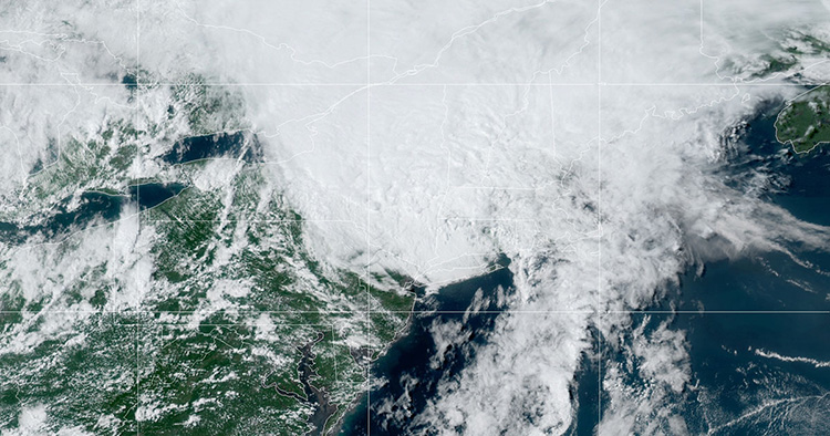
Image at top: Tropical Storm Isaias. Credit: NOAA/NESDIS/STAR GOES East satellite


