Kai-Chih Tseng interview: Global rainfall pattern could extend predictions by 3 weeks
Earth’s atmosphere is chaotic, making it difficult for forecasters to predict weather more than 10-13 days in advance. However, research has increasingly shown that large-scale patterns of variability and relationships between states of the atmosphere in two faraway locations, called “teleconnections,” can help extend prediction skill beyond this limit.
“Few researchers have applied this mechanism to weather prediction,” said Kai-Chih Tseng, atmospheric science graduate student at Colorado State University (CSU). “Especially from two weeks to three months, which has been known as a ‘prediction desert’ in the past.”
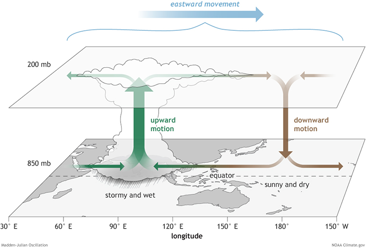
A new study led by Tseng says that teleconnections with certain phases of a recurring tropical rainfall pattern could extend predictions up to 20-25 days in advance. The study is co-authored by Assistant Professor Libby Barnes and Professor Eric Maloney, both in CSU’s Department of Atmospheric Science.
The authors’ findings provide guidance on which tropical conditions might lead to improved forecasts beyond our current capability – and more time to prepare for extreme events.
Read the full NOAA Climate Program Office article.
Graphic at top: Upper Atmosphere Graphic of Madden-Julian Oscillation The surface and upper-atmosphere structure of the MJO when the enhanced convective phase (thunderstorm cloud) is over the Indian Ocean and the suppressed convective phase is over the west-central Pacific Ocean. Source: Climate.gov


